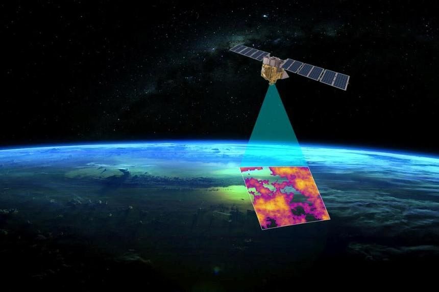
SAN FRANCISCO – Alphabet Inc’s Google will work with a unit of the US-based non-profit environmental group Environmental Defence Fund (EDF) to help track and attribute methane emissions observed by the group’s MethaneSAT satellite that is scheduled to blast into orbit on a SpaceX rocket in March.
The effort harnesses artificial intelligence and mapping expertise from one of the world’s most influential technology companies and applies it to data from a high-powered satellite dedicated to observing some of the world’s most devastating and avoidable greenhouse gas emissions.
The goal is to better identify opportunities to reduce emissions and unlock more aggressive climate action from governments and fossil fuel operators, many of which have committed to significant cuts by 2030.
“Our mission is about action and helping countries, companies and communities track and reduce emissions faster while documenting their progress,” Dr Steve Hamburg, chief scientist at EDF, said according to a transcript from an online briefing with journalists. “It is also about accountability, giving policy makers, investors and the public the unprecedented ability to see and compare those results.”
The announcement comes as methane action gains support. The US, the European Union and China announced efforts in 2023 to boost monitoring and reporting of methane in a bid to crack down on emissions. More than 150 nations have committed to reducing global releases of the potent greenhouse gas 30 per cent by the end of this decade compared with 2020 levels as part of a Global Methane Pledge. Fifty of the world’s biggest oil and gas producers pledged at the COP28 climate summit to significantly cut methane emissions by 2030.
Scientists with the EDF unit will use Google Cloud computing and storage to run an algorithm on satellite observations from MethaneSAT to identify releases of the gas and trace the emissions back to their source. Attributing methane emissions to individual pieces of infrastructure and companies remains challenging because some operators and governments do not disclose ownership or types of equipment.
To help with that, the same Google team behind other mapping services like Google Maps, Street View and Waze will use AI to identify in satellite data oil and gas infrastructure like well pads or storage tanks – all of which can leak. “Once we have that map, then we can overlay methane data,” Dr Yael Maguire, head of Google’s Geo Sustainability team, said during the briefing. This will provide a “far better understanding of the types of machinery that contribute most to methane leaks”.
Methane, which is invisible to the human eye, is the primary component of fossil gas and has more than 80 times the warming power of carbon dioxide during its first 20 years in the atmosphere. Halting releases of the gas from fossil fuels is widely viewed as one of the cheapest, fastest ways to curb global warming in the short term, buying time to make the deep carbon dioxide cuts needed to avert serious climate harm.
Methane emissions from oil, coal and gas operators often represent a tradeoff between profits and the climate. Although it is possible to eliminate the vast majority of the releases, doing so can increase costs in the short term and slow output.
Underground coal mines, for example, actively vent methane after the gas is released from rock strata to avoid explosions. Few use available capture technology, though. Gas operators routinely vent methane when they need to empty a pipe to make it safe for repairs, even though recompression equipment can cut these emissions.
Methane releases from fossil fuels are significantly underreported. EDF scientists found that emissions from US oil and gas operations were 60 per cent higher than Environmental Protection Agency inventories suggested in a 2018 study, and new empirical evidence using satellite observations suggests that methane from global oil and gas operations are 30 per cent higher than figures reported to the United Nations under the Paris Agreement.
Despite commitments by both companies and governments to reduce emissions, it is not clear that more data will necessarily trigger cuts absent stronger regulation. Satellite observations of methane have been available for years and many of the world’s hotspots, such as coal mines in China’s Shanxi province and oil and gas operations in the US’ Permian Basin, are well known and continue to release vast amounts of the gas.
There has been no overall reduction in methane emissions from fossil fuel basins in many of the world’s biggest oil, coal and gas producers that are signatories to the Global Methane Pledge, except for the Bowen Basin in Australia, according to an analysis of satellite data from Kayrros SAS released in December. The study used satellite observations and examined emissions rates since 2020.
Operators are not always receptive to new satellite data that reveals their emissions. Some companies, including Petroleos Mexicanos, the state-owned energy giant known as Pemex, have pushed back on widely accepted science and peer-reviewed reports that documented leaks, arguing researchers mistook nitrogen or water vapour for methane in satellite data.
The International Methane Emissions Observatory, a UN-backed effort to reduce methane emissions, notified stakeholders about 127 releases from March through November in 2023, but it could verify that only one release was halted. The group did observe other cuts but did not receive enough information to verify specific actions taken by operators.
“We think this is a moonshot,” said Dr Maguire. “We think that with these tools that we can empower businesses most and the public sector with technology and information to take collective action.” BLOOMBERG