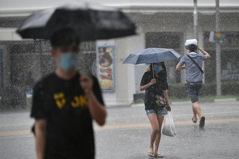

Expect wetter weather in the second half of this month, said the weatherman yesterday.
Thundery showers are expected on most days over the next two weeks between late morning and afternoon, and could also occur on a few nights, according to the National Environment Agency's Meteorological Service Singapore (MSS).
In addition, widespread thundery showers with gusty winds could sweep through Singapore on one or two mornings.
The MSS said this is due to the passage of Sumatra squalls, which are lines of thunderstorms that usually develop at night over Sumatra or the Strait of Malacca. They typically move east towards Singapore in the early morning hours.
While more rainfall is expected in the second half of August than in the first, total rainfall for the month is forecast to be near average over most parts of the island.
The wetter weather could provide brief respite from the heat in the days ahead. Temperatures on most days in the latter half of August should range between 25 deg C and 33 deg C, with highs of around 34 deg C on a few particularly warm days.
A few warm and humid nights are also forecast, with temperatures hovering at about 28 deg C.
In comparison, for the first half of the month, the highest daily maximum temperature recorded was the past Sunday's 35.4 deg C, while the daily maximum was above 33 deg C on most days.
On a few nights, the daily minimum temperature over the southern, eastern and western coastal areas of the island was above 28 deg C.
Drier weather was also experienced in the first half of August as the monsoon rain band was situated over northern South-east Asia, resulting in drier weather over equatorial South-east Asia, including Singapore.
Many areas received well below average rainfall, with that in Sentosa island, in particular, falling 84 per cent below the average.
There were, however, a few days when Singapore saw thundery showers due to the passage of the Sumatra squalls.
National water agency PUB said heavy rain yesterday morning caused brief flash floods at the junction of Craig Road and Tanjong Pagar Road, which subsided after 10 minutes.
On Thursday, PUB said a heavy downpour resulted in accumulated water in Aljunied Road, below the Pan-Island Expressway flyover, at around 7am.
The day's highest daily total rainfall of 115.6mm was recorded in Bedok South.